← Back to projects / AirTOP Integration
Navigation-data preparation utility PUBLIC PORTFOLIO VIEW

AirTOP Integration

PDF Waypoint Importer

Extracts waypoint definitions from authorised PDF documents, validates coordinates and supports controlled AirTOP creation or update.
ROLE PDF extraction, coordinate validation and AirTOP waypoint workflow engineering
DELIVERY MODEL Specialist-governed · Human-reviewed
AirTOP API Java Apache PDFBox Coordinate Validation 2D Review
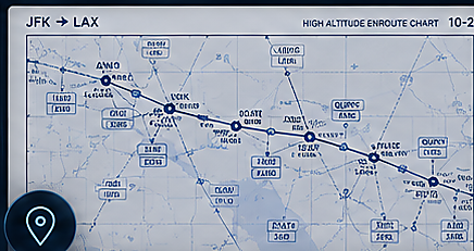
PDF Waypoint Importer public interface preview
CAPABILITY PREVIEW Public-safe interface representation
Privacy and confidentiality protected

Public portfolio summary. Restricted charts, source documents, operational coordinates and internal model datasets are intentionally excluded.

01

PROJECT OVERVIEW

From operational need to controlled delivery

A

THE CHALLENGE

Operational need

Navigation data published in PDF format can require slow manual re-entry and creates a risk of coordinate transcription errors.

B

ENGINEERED RESPONSE

Solution approach

The utility extracts waypoint names and coordinates, compares them with current model content and presents explicit create, skip or update decisions.

C

VALUE CREATED

Operational impact

Accelerates navigation-data preparation while retaining specialist review and transparent current-versus-proposed comparison.

02

CONTROLLED WORKFLOW

A clear specialist-led path from source to result

01

Select PDF

Load an authorised navigation document

02

Detect structure

Identify waypoint and coordinate columns

03

Extract records

Read names, latitude and longitude values

04

Compare model

Check existing AirTOP waypoints and locations

05

Specialist review

Approve create, skip or update decisions

06

Import & report

Apply changes and preserve outcome counts

03

DEVELOPED CAPABILITIES

Complete public-safe feature inventory

The list below describes the developed capability without exposing operational records, source-system credentials, private mappings or proprietary implementation details.

01

PDF document processing

Reads approved navigation data from structured PDF content.

  • Loads an authorised PDF from a specialist-selected location.
  • Detects the required waypoint and coordinate fields.
  • Extracts waypoint designators, latitude and longitude values.
  • Handles repeated headers and page boundaries.
  • Normalises text before coordinate validation.
  • Reports documents that do not contain the expected structure.
02

Coordinate validation

Reduces transcription risk before model changes are made.

  • Validates latitude and longitude formats.
  • Checks coordinate ranges and hemisphere indicators.
  • Normalises approved coordinate notation.
  • Flags incomplete or ambiguous records.
  • Prevents invalid coordinates from being committed.
  • Keeps the original extracted value visible for comparison.
03

Existing waypoint comparison

Shows the difference between document data and current model content.

  • Checks whether each waypoint already exists in AirTOP.
  • Highlights existing records in the review grid.
  • Compares current and proposed coordinates.
  • Shows create, unchanged, different and invalid states.
  • Prevents unintended overwrite of existing waypoints.
  • Supports a clear specialist decision for each record.
04

Controlled create and update

Applies only the changes explicitly approved by the specialist.

  • Creates missing waypoints after validation.
  • Skips unchanged existing records.
  • Updates coordinates only when the update option is explicitly enabled.
  • Reuses existing model objects where appropriate.
  • Separates created, updated, skipped and failed outcomes.
  • Avoids silent changes to existing navigation data.
05

Visual review and route support

Helps the analyst understand extracted locations and sequence.

  • Shows selected points in a 2D location view.
  • Supports zoom and spatial review of proposed coordinates.
  • Preserves document order for route preparation.
  • Flags missing elements in a proposed route sequence.
  • Allows route-support data to be reviewed before creation.
  • Keeps coordinate evidence linked to the source record.
06

Import reporting and privacy

Documents the result without publishing restricted navigation data.

  • Displays processed, created, updated, skipped and failed counts.
  • Exports a specialist review summary where required.
  • Keeps source documents outside the public website.
  • Does not publish operational coordinates in portfolio content.
  • Separates public capability descriptions from model data.
  • Supports secure local use within the authorised environment.
04

SOLUTION ARCHITECTURE

High-level design without sensitive implementation exposure

01

Authorised PDF

Specialist-selected navigation document

02

PDF extraction layer

Structured text and table interpretation

03

Coordinate validator

Format, range and ambiguity checks

04

AirTOP comparison

Existing waypoint lookup and location review

05

Controlled import

Create, skip or approved update plus summary

05

CAPABILITY EVIDENCE

Designed outcomes

Faster waypoint preparation from approved documents.

Reduced coordinate transcription risk.

Transparent current-versus-proposed comparison.

No unintended overwrite of existing model content.

Restricted charts and coordinates remain private.